Passau – Ameisberg

Stage   no. 38
Date Saturday 25 October 2003
Distance stage      41,5 km
Distance acum. 1543,0 km
Quality of signs Good
Quality of the hike C (good): grey and boring; on a sunny day probabely very worthwhile

The night train is exactly on schedule to drop me off for my two day trip. At 05.10am I walk out of the railwaystation of Passau, into the freezing cold air. I cross the river Donau/Danube on my way to the area of Ilzstadt, where I stopped my stage during my latest trip.

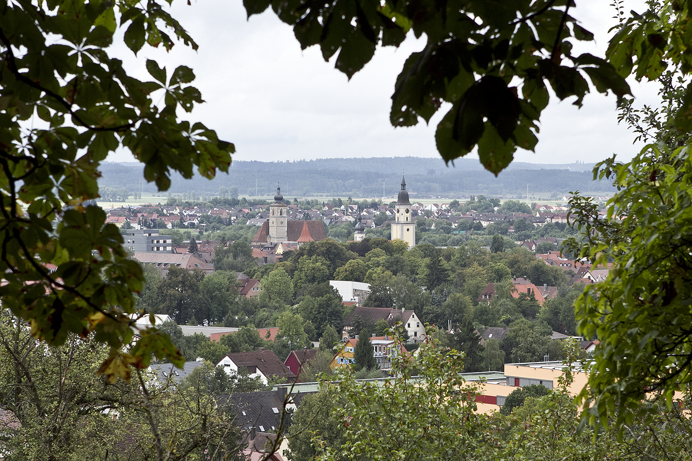
Starting there, I pick up the signs again, further eastbound. During the morning hours the weather is reasonably nice but it remains very chilly and cold. After 13 km, beyond the village Wingersdorf, I pass the memorial sign that states that the views from this spot has obtained “imperial approval”. It is so typically German to put up a sign like that, but I have to admit: the view from the small hill overlooking the surroundings is very nice. Afterwards the path leads through a deserted scenic area. The autumn colours make it look very beautifull. After passing the village Kropfmühl (23,5 km) my focus is fixed in the southeast direction: to the Austrian border. The weather has gone bad and it threatens to start to rain or snow. Sometimes the threatening stops. . . Along the way I chat a bit with the last German fellow that I meet with in Germany during the E8 and at 3.25pm, at 1.537,5 km from my starting point in Amsterdam, I pass the German-Austrian border. My E8 goes into its next phase. I walk another 5,5 km in Austria and decide, just before sunset, to spend the night on top of the Ameisberg hill (941 meter altitude).

Fortunately, the inn that is situated up there next to the watchtower is opened. I have a delicious meal, enjoy the warmth of the stove, take a hot shower and go early to bed.

Geplaatst in 4 - Germany, 5 - Austria | Tags: | Plaats een reactie

Zenting – Passau

Stage   no. 37
Date Sunday 1 December 2002
Distance stage     54,5 km
Distance acum. 1501,5 km
Quality of signs Good
Quality of the hike A (fantastic!): variation, impressive and very worthwhile

I get up at 6.15am and put on my wet shoes. After a fast breakfast (“I will eat the rest while walking”) I start walking at 6.35am. It is still dark and the sky is fortunately dry. I have a tough day ahead: I want to finish today in the city of Passau, and if I manage to keep the same pace as yesterday I will get there just before sunset.

My Petzl headlight serves me well again during the first hour. In the twilight I have some difficulties to find the direction of the Trail when I cross a meadow, but once I have found the exit I continue at full speed. After a wonderful sunrise some dark clouds start to head in my direction. The Trail up to Saldenburg is nice and full of variety. After this village and the woods behind it the trail starts to follow the river Ilz. Gert Trego “warns” everybody in his description, as he wrote:  “For the walk through the Ilz valley one should take the time. It is worthwhile.” As often before, he is very right about it: the valley starts as a very narrow and steep valley with a small stream chattering through. During the next 30 kilometers it becomes wider and more and more beautiful. The enjoyment reaches a remarkable high at noon when the sun starts to shine. In a beautiful winter sunshine I walk all the way through the Ilz valley, in the pace of a horse that smells the stable (old Dutch saying). The trail has lots of variation and is not as flat as I had expected it to be. I meet with several other walkers (not long distance hikers) and we chat a little. Just before Passau the Ilz floats into a big lake. After passing this one, I pass the village of Hals. For the first time in 35 kilometers I see cars again. 15 Minutes later I reach my first moment of glory of todays stage: I get to the 1500 kilometer mark of my hike to Vienna. 1.5 Kilometer further down the road, at 3.20pm, I arrive in Passau, my last finish in Germany.

According to Trego’s calculations I have covered today my third largest stage. Again, he has calculated the distance very mildly; if he is right I have walked with an average of 6,1 kilometer per hour. I take a look around teh city centre of Passau, but without full excercise it is cold outside. A great day!

Geplaatst in 4 - Germany | Tags: | Plaats een reactie

Gotteszell – Zenting

Stage   no. 36
Date Saturday 30 November 2002
Distance stage      43,0 km
Distance acum. 1447,0 km
Quality of signs Good
Quality of the hike B (great): nice and variation. Too bad for the fogg and the rain.

Two weeks after my previous trip I am now back for a two-day trip in the Bavarian Forrest. Due to a delay of the night train I can only start walking this morning at 10.40am. It rains steadily, but it’s not pouring. Right from the start the first hill of today will have to be climbed: the Oberbreitenau (1021 m), which means 500 meters altitude ascend. At the top (where due to the fogg there is less than 20 meters visability) I notice that the rain on my sweater changes to wet snow. I decide to put on my rainjacket and start the boring descend through the forrest. After passing the village of Kapfing, I come to walk through a lovely valley: again, it is a typical miniatur railroad landscape in real proportions, with the village of Lalling as eye-catcher. After I have crossed the valley I have to do the second climb of today: the Brotjacklriegl (1021 m). By the time I am just below the top (at 4.30pm) it gets too dark to continue without a headlight. Wearing my Petzl I continue my way. It is no problem to make it to the top and consequently the descend is also in the dark well to be done. Due to the enormous rain showers of the past days  a lot of paths that I have been using today are very wet and swampy. Especially in the dark it turns out to be inevitable to get a “wet foot”. At 7.00pm I arrive in the village of Zenting.

I camp at the biggest meadow in the village. I have hardly any problems with my feet, and this gives me courage for tomorrow. In the description of Gert Trego he has used his rubber lineal to measure the distance of my stage of today. If his calculation is correct, I am supposed to have walked today with an average of 5,0 kilometers per hour. I have my doubts, just like when Trego miscalculated in my disadvantage. I guess we are even now.

Geplaatst in 4 - Germany | Tags: | Plaats een reactie

Stallwang – Gotteszell

Stage   no. 35
Date Monday 18 November 2002
Distance stage      50,0 km
Distance acum. 1404,0 km
Quality of signs Good
Quality of the hike B (great): nice, tough and some great views

Again, I travel to the south of Germany for just one day of pleasure. The descriptions of Gert Trego sound very promissing for today’s stage, but also a lot of tough kilometers are waiting for me. I take the night train to Straubing and the bus to Stallwang.

At 6.45am I start in Stallwang at the same busstop where I left the previous time. After the twilight has faded the grey skies are left behind, with some blue spots here and there. The first 8 kilometers to the village of Konzell are nice and full of variation. After this part the first climb of today needs to be done: the Kreuzjoch hill (approx. 900 m altitude). Gert Trego is almost lyrical when he describes the view from the top of the hill, and even on a gloomy day like I have today I must admit that he is very right about it; the view to the north (Bavarian Forrest and Czech Republic) is impressive. After a long descent (down to 300 meters altitude) the next climb starts: the Hirschenstein hill (1095 meters altitude). I manage to keep my steady pace without too much problems (the advantage of one-day-hikes is that you hardly have any luggage with you) and I enjoy the view from the top of the hill, from the tower that’s up there. On the panoramic map that is installed on the tower the mountains are identified that can be seen from this location (on a day with good visability of course). The furthest mountain appears to be one that I know well: the Gossvenediger in Austria (230 kilometers to the southeast). The view overlooking the lower Donauvalley is very worthwhile as well. After a short and steep descend the third climb of today starts: the Vogelsang hill (approx. 1000 meters altitude). The trail does not go all the way to the top as there is no view anyway due to the trees. Altogether I have climbed today some 2200 meters and descended 2000 meters. Even on a tough day in the Alps this is hard to cover! After the final descend I arrive in the village of Gotteszell. The railway station is situated next to the trail and just as I arrive at 5.00pm, it starts to rain for the first time today.

The nighttrain takes me home again.

Geplaatst in 4 - Germany | Tags: | Plaats een reactie

Sinzing – Stallwang

Stage   no. 34
Date Sunday 14 April 2002
Distance stage      55,5 km
Distance acum. 1354,0 km
Quality of signs Good
Quality of the hike C (good): disappointingly few nice veiws

After 13 months of standstill I pick up the Trail where I left it. Due to circumstances I travel to the south of Germany for just one hiking day. During the next 200 kilometers the means of (public) transportation are very minimal. The path hardly passes railway stations or even bus stops, so the length of the stages is pretty much determined.

On this gloomy springtime day I do another one of my huge stages. First I walk from the village of Sinzing to the city of Regensburg, crossing the river Donau. The official Trail stops at the outskirts on the westside of Regensburg and it continous at the eastside of the city. According to Gert Trego’s descriptions the missing part can be covered by busses. I choose to walk the entire way (which I also did in the city of Koblenz), which causes me to do an extra 11 kilometers. The missing part includes suburbs, city centre and a huge industrial area on the eastside of the city. After passing the village of Donaustauf I have to cross a huge forrest park (“there are no signs in the park”, Trego says). Indeed, there are no signs at all, which causes me to walk another extra 7,5 kilometers. After this “excitement” the path continous up and down the smooth hills of the Lower Bavarian Forrest, further eastbound. The area looks lovely, just like in a miniature railroad landscape, even without the sun and without fresh awaking nature like today. Finally, after having walked 76 kilometers, I arrive in the village of Stallwang. I am releaved to see that the timetable that I had checked on the internet is the same as in reality.

I am exhausted, but very satisfied.

Geplaatst in 4 - Germany | Tags: | Plaats een reactie

Wolfsberg – Sinzing

Stage   no. 33
Date Sunday 9 March 2001
Distance stage      53,5 km
Distance acum. 1298,5 km
Quality of signs Good
Quality of the hike C (good): nice, but a boring experience 

Today I walk the second day of my two day hiking trip.

I walk from dawn to sunset in the pouring rain. The trail goes downstream along the river Altmühl, and consequently along the canal connecting the Altmühl with the river Donau. It is a dark, quiet and boring day. The few villages that I am passing look deserted and everybody is indoors (I can’t blame them in this kind of weather). Near the village of Kelheim the Altmühl floots together with the Donau and the E8-trail goes left crossing the hills directly to the city of Regensburg. Due to a knee injury I do not make it up to Regensburg today. I decide to call it a day in the village of Sinzing, one of Regenburg’s suburbs.

I catch the train back home. While waiting for my connection, I order a plate of livercheese with backed potatoes and a fried egg (local specialty). Started in Amsterdam I have covered almost 1300 kilometers, and it was worth while all the efforts.

Geplaatst in 4 - Germany | Tags: | Plaats een reactie

Eichstätt – Wolfsberg

Stage   no. 32
Date Saturday 8 March 2001
Distance stage     53,0 km
Distance acum. 1245,0 km
Quality of signs Good
Quality of the hike C (good): nice area, but a bit boring 

The nighttrain drops me off in the city of Eichstätt at 5.30am for two days of hiking fun along the E8. I start immediately to walk.

It is a wonderful early-spring day during which I walk in short sleeves (approx. 13º) along the river Altmühl heading in the northeast direction. The valley that I am walking along is wide and has some nice views. There is also the famous castle, situated highly on a cliff, overlooking the entire valley. Near the village of Kinding I cross another landmark: the highway Nürnberg – Münich. This is another milestone in my E8-experience, as I have been driving this highway many times up and down, between the Netherlands and Austria. At moments like this I have the strong feeling that I am very far from home. I continue to walk without any problem along the river until sunset.

During the night it begins to rain. Later on it starts to pour . . . .

Geplaatst in 4 - Germany | Tags: | Plaats een reactie

Pappenheim – Eichstätt

Stage   no. 31
Date Sunday 25 June 2000
Distance stage     27,0 km
Distance acum. 1192,0 km
Quality of signs Good
Quality of the hike A (fantastic!): nice, impressive  and lots of variation 

After another good night rest I continue my limping. Today is my third and last day of this trip, and eventhough I am still excited about continuing I am looking forward to go back home tonight.

After breaking up at the camping site along the river I cross Pappenheim and leave the city.

now I can truly say: I know the Pappenheimers

now I can truly say: I know the Pappenheimers

Today it takes even up to two hours of limping/walking before I can put my feet straight on the ground. The weather is fantastic summertime weather and there are a lot of kano-ers, hikers and cyclers on their way. Walking along the river Altmühl I arrive at 3.00 pm at the village Hoch-Eichstatt. The trail leads up the hill, prettu steep, but not for too long, and it is rewarded with a nice view overlooking the valley.

high over the Altmühl valley

high over the Altmühl valley

On the other side of the hill the Trail goes down the hill, to the city of Eichstätt. It looks, from the top off a hill very nice and impressive, but the pain in my feet makes it impossible for me to pay a lot of attention to it. I had hoped to be able to walk further than just Eichstätt today but my speed is very slow (approx. 3 km per hour!) and I am not enjoying it.

In the evening I watch a football game of our national team against Jugoslavia (the legendary quarterfinal of the Euro 2000 chanpionships, Netherlands wins with 6-0 the biggest score ever achieved after the first round on a European Championship). Later in the evening I take the train from Eichstätt to Crailsheim and drive back by car to the Netherlands.

Geplaatst in 4 - Germany | Tags: | Plaats een reactie

Hesselberg – Pappenheim

Stage   no. 30
Date Saturday 24 June 2000
Distance stage     43,0 km
Distance acum. 1165,0 km
Quality of signs Good
Quality of the hike C (good): interesting stage, but not special 

After a good night rest I wake up early in the morning to start my second day of this three-day trip.

I start by walking down the Hesselberg, down to the village of Wassertrüdingen.

top of the Hesselberg Hill

top of the Hesselberg Hill

Later on I pass some other villages in the scenic landscape of the Frankenland.

trailsign

trailsign

The blisters on my feet of yesterdays’ walk cause me a lot of trouble and pain and it takes about one hour walking before I can put my feet straight down.

The trail follows the river Altmühl. There are a lot of kanoo stops along the river Altmühl, and some nice views. I walk to Pappenheim (Western European saying: “Who doesn’t know them, the Pappenheimers?”). Walking along a river is easy (you will not easily make a mistake!) but it is also some kind of boring. Just before sunset I arrive at the campingsite in the village of Pappenheim.

I only have a bivouac sack with me, and I turn out the be the guy with the least luggage on the camping. The hot shower and the care for my feet are a blessing. During the night it rains.

Geplaatst in 4 - Germany | Tags: | Plaats een reactie

Crailsheim – Hesselberg

Stage   no. 29
Date Friday 23 June 2000
Distance stage     52,0 km
Distance acum. 1122,0 km
Quality of signs Good
Quality of the hike B (great): nice stage with a beautiful finish on top of the Hesselberg hill 

I arrive back in Cralsheim after six months by taking the red eye train. I have planned a three days hiking trip along the E8. I have a short night with not much sleep due to the annual summer festival in Crailsheim.

view on Crailsheim

view on Crailsheim

I started my walk at daybreak. The weatherforecast is very good, with lots of sunshine and nice summer temperatures. After one hour of walking I have wet feet due to the high grass in the meadows that the Trail is crossing. This causes me to have blisters later during the day. After a few hours I arrive at the small city of Dinkelsbühl. It is well know for its well kept ancient city centre. The E8 leads straight through the main street, along terraces, shops, fountains and other scenic locations.

colorfull Dinkelsbühl

colorfull Dinkelsbühl

At the end of the morning there are hills appearing on the horizon. During the next hours the Trail goes straight towards them, I come to realize that  the highest of these hills is the Hesselberg, and that the E8 leads directly to the top of it. At 4.00pm I realize I am very tired and I take a short nap in an easy meadow by the side of the countryside road. I have to build up some energy for the Hesselberg. The climb on this impressive hill in the early evening hours is not so tough as I was fearing. There are still people walking up and down the hill during the evening hours. The view from the top is spectacular, in all directions. The nearest villages are far in the valleys, and the evening is very peacefull.The Hesselberg is a very solitude hill overlooking the plains of Southern Germany in all directions.

Geplaatst in 4 - Germany | Tags: | Plaats een reactie