
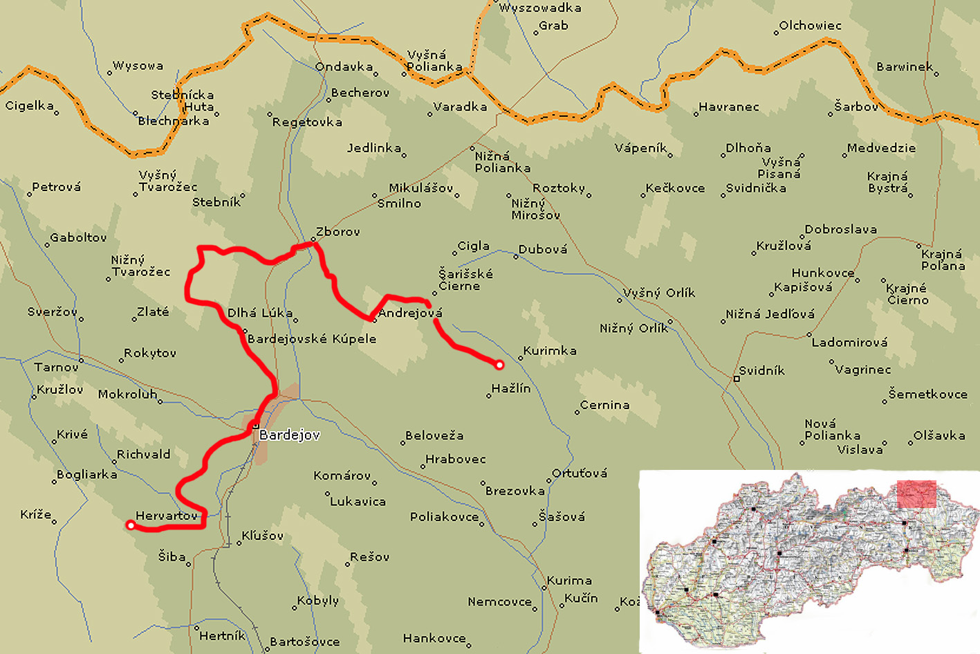
| Stage no. | 72 |
| Date | Saturday 1 June 2013 |
| Distance stage | 38,0 km |
| Distance acum. | 2694,0 km |
| Quality of signs | good |
| Quality of the hike | C (good): hills, fields |
After travelling through the Czech Republic to catch the famous night bus eastbound in Brno, I arrive in the early morning in Hervartov, for three days of hiking pleasure along the E8.
Hervartov has not changed in the past 52 weeks. I take the inevitable picture of the wooden church and follow the road down the valley, and later uphill to the village of Mihalov. The views to Hervartov in the south, behind me, are nice. On the other side of the hill, descending to Bardejov, the E8-signs stop where the path enters the regular road. I follow, according to the map, the regular road downhill to the city, and just at the beginning of the residential area of Bardejov the signs apear again. I pass a small weekmarket (mainly vegetables and fruits) and the famous, Unesco-awarded, ancient city centre. It is still early on the Saturday morning and I take some inevitable pictures of the, empty, square.
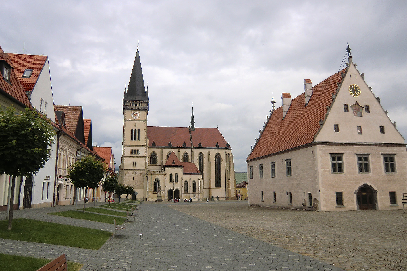
Ancient Central Square in Bardejov
I continue northbound, after leaving the city through fields and trees to Bardejovske Kupele. It’s a small village full of various types of spa’s; some operational, some closed and worndown for many years. By then I have already soaken wet shoes due to the wet grass and bushes along the way. After leaving the village the ascent of the Magura Hill starts; in the beginning it’s easy, but after passing the Sedlo Ceresna Pass it gets much steeper. The condition of the path is not comfortable; the soil is slippery due to the rain and there are many plants and bushes that cover part of the path, due to backlogged maintenance. By the time I arrive at the top of the hill I am convinced that this is a complete useless waste of time and energy; there is no view at all from any part of the hill including the top, the path is uncomfortable to walk, and it leads to the next village of Zborov, where you can get a lot of easier by following the regular road from Bardejov. After the descent from the Magura Hill the path does use the regular road for some kilometers to get finally to Zborov, anyway. After crossing the village the Trail leads out of Zborov through the gipsy-quarter. There are no signs to be found in this part of town, but with the help of the friendly people I find a red arrow on the last Telephone stand at the end of the street. I go left up the hill where I have to walk another 15 minutes to find the next sign, which is not comfortable.
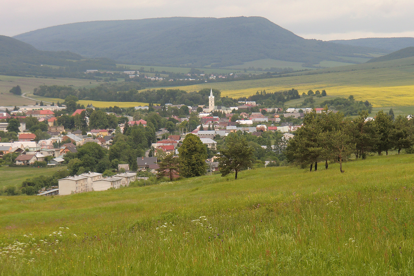
view on Zborov
I continue my way to the village of Andrejova, in the final section crossing a huge field (no signs) with very wet vegetation. I try to find a place to stay for the night in Andrejova, but without succes. I continue my way up the hill, following the signs along the regular road. After 15 minutes or so the signs show to go right, straight up the hill through the fields. After a few minutes the path starts to cross a very dense forrest with very low hanging branches from the trees. I can not walk straight up all the time, and due to the high frequency of the trees there is hardly any daylight popping through the leaves, although it’s only 5.00pm or so. All of a sudden, with a blow, a huge downpour starts which creates an incredible noise from the leaves in the trees. Nevertheless, they prevent me from getting wet at all! Higher up the hill, still being able to follow the signs the forrest is less dense and I get my share of the rain. At some point the forrest road leads up the hill comfortably, but I realize that I have lost the signs again. I decide to walk straight east with my compass to arrive at the ridge of the hills where I should be able to pick up the Trail again. After some slipping and sliding, it is still raining cats and dogs, I arrive at the ridge, and after less than a minute the white-red-white signs pop up again, coming from the right (south, different from the drawning on the map!) and joining me on the ridge, southeast bound. The Trail follows the ridge, uneventfull, no views, and the rain keeps pooring down. At the foot of the Olha Hora hill, which is the first open section that you pass on the ridge, I seek shelter in a small hunters cabin; it’s small but dry. I decide to stay there for the night, not being motivated to walk any further through the pooring rain.
