
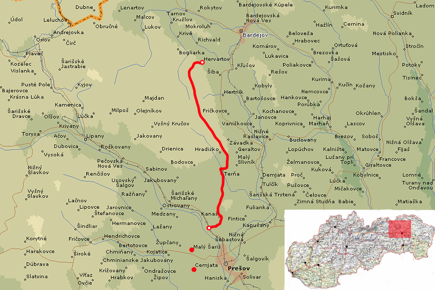
| Stage no. | 71 |
| Date | Wednesday 30 May 2012 |
| Distance stage | 32,0 km |
| Distance acum. | 2656,0 km |
| Quality of signs | reasonable |
| Quality of the hike | C (good): hills, fields |
I was up early. The nightguard was supposed to give me my breakfast, but he was nowhere to be found. At 3.30am I am back on the Trail again, on my way in the dark to the village of Kanas. This is well to do as the Trail uses the regular road. After crossing Kanas in the twilight I enter the First forrest section of today. I see some wild boar that are looking for their breakfast (fortunately they don’t consider me). In this first forrest section there is more path-finding to be done than you would expect from the drawings on the map; many junctions and parallel paths, but the signs sometimes go straight through the bushes and trees. Unnecessarily anoying. After leaving the forrest I cross the fields and appear to have missed the right direction, and I end up walking along the regular road to the village of Terna, in stead of through the fields. In Terna I pick up the E8- signs again and continue my way to the village of Hradisko, and through the fields and the trees beyond. I end up at the pass Sedlo Cergov, where there are many small cabins and refuges, but they are all closed in the summer season.
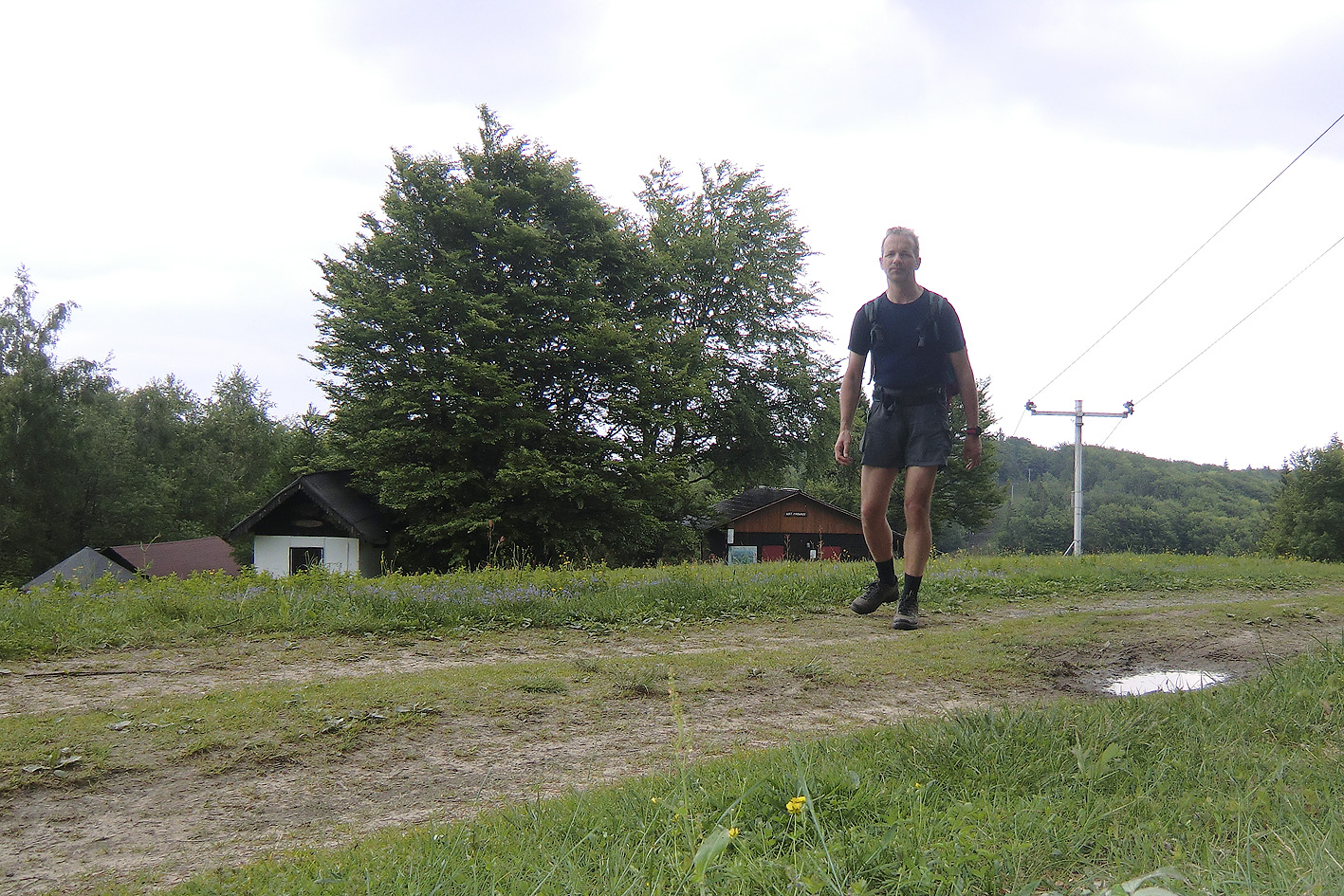
Passing Sedlo Cergov
The next kilometer is a special one: the E8-Trail is joining here the newly marked E3-Trail. The specialty is that on this section the E8 goes north/east to the Duklapass, and that the E3 that comes from the opposite direction leads south/east to the same Duklapass. After a few minutes I meet two Slovakian hikers, on their trans-Slowakian-trail, from the Duklapass to Bratislava along the E8. We chat a little bit, about the conditions of the next few kilometers, and about the soccer game between Slovakia and the Netherlands that is being played this evening. Further down the path, the Trail uses the mountain ridge that leads straight north. At some point, after I have not seen signs for many minutes, there are white-red-white signs that lead to the east, downhill. I loose a lot of time not knowing how to continue, as I expect to have to follow the ridge for some time. This appears to be correct, in the end, after walking down a few minutes, going back, down again, etc. I decide to follow my compass and instincts and continue to follow the ridge, and after 5 minutes the next e*-sign shows me that I am correct. After an hour or so I end up at the forrestroad to leads me at the end of the ridge downhill; it is clearly identifiable, and steep. Down in the valley I loose the signs again and I continue my way through the fields to the next village, Hervartov. After a few minutes I arrive there and I am startled to see in the central square a very well kept ancient wooden curch. The E8-signs appear to cross the church compound directly, entering from the other side. On the other side of the square there is a simple inn where I am able to spend the night.
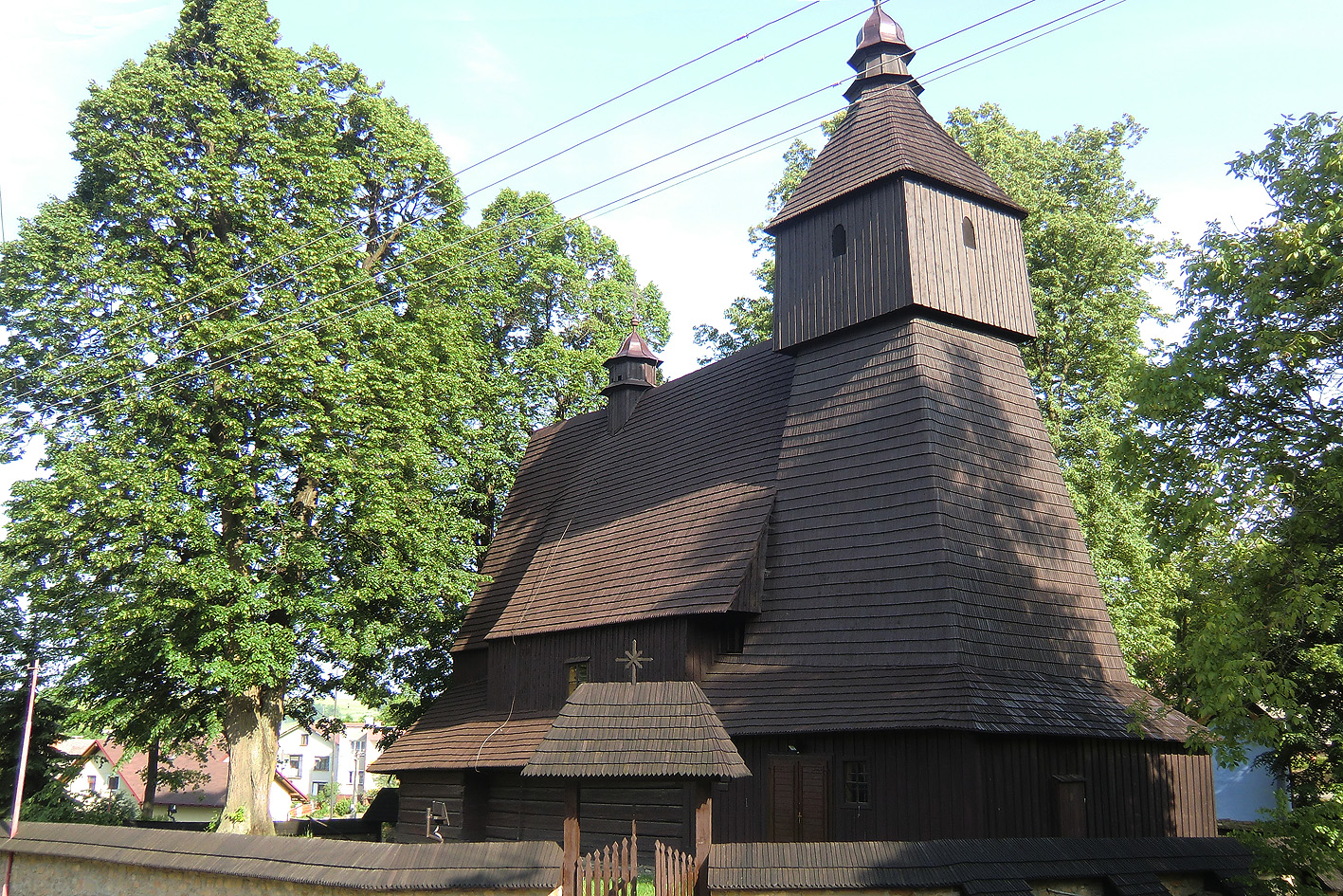
Oldest wooden church in Slovakia (16th century)
The inn-keeper lives a minute down the road, and after I called the number that was on the front door of the inn she shows up and signs me in. She gives me the telephone number of a pizza-delivery service (there is no restaurant or so in the very small village of Hervartov) and 25 minutes later I enjoy a salami pizza and two bottles of Coke. The next day I decide not to continue due to my blisters. The inn-keeper is also the keeper of the old church and she shows me around, together with a schoolclass of Slovakian 12-year olds. It’s very impressive, and I have the feeling that I am far from home.
