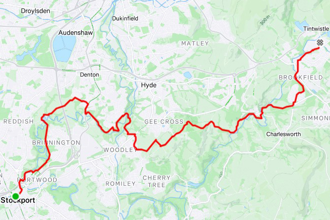
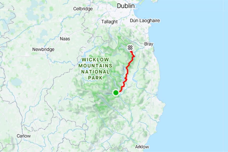
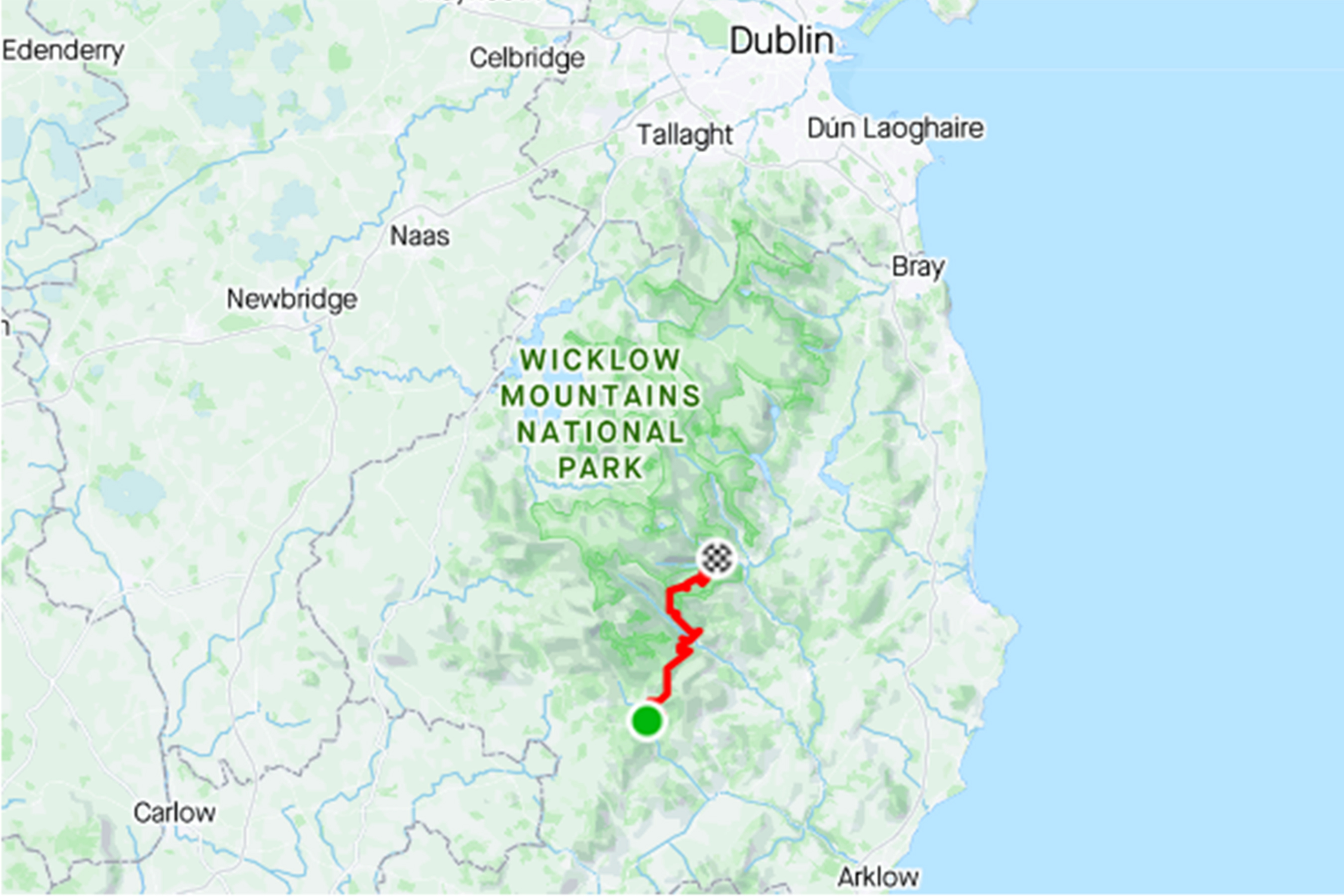
Stockport – Hadfield

Stage no. 98
Date Friday 22 August 2025
Distance stage      26,5 km
Distance acum. 3.640,5 km
Quality of signs good
Quality of the hike B (interesting): interesting up the first UK hills

https://www.strava.com/activities/15544221522

Link to Strava

For many months I have looked forward to this stage: I will be crossing the Penine Hills, part of the Peak District national park. As the possibilities for overnight stay are very limited I have scheduled to make one of those long days, some 50+ km’s.

I start in the morning at 02:30. The trail leads me through the city center of Stockport. At this hour of the night every three minutes there is an airplane coming over on its way to the landing strip at Manchester Airport. The trail start ascending in a gentle way, it crosses some parks for many kilometers, continuously going uphill. After dawn I have some nice views to the west/north.

view over the lower lands

The weather is very comfortable for hiking; some 15 degrees and cloudy. The trail goes up and down the slopes gently, for not too big swings. Although I am still close to the big city of Manchester, which is confirmed by all the air traffic, the surrounding is lovely.

countryside

After some 20 km’s I feel that I have difficulty in maintaining a moderate pace, I don’t feel well. I take some extra breaks, but that don’t change much. When I reach the village of Hadfield, the last village before the, sort of, remote Penine Hills, I decide that this is not one of those days and I call it quit for the day at 10:00 in the morning.

The rest of the day I use to get a medical confirmation of physical condition. At 16:30 the doctor confirms that there is no objection to continue with what I am doing, carefully.

Geplaatst in 2 - United Kingdom | Tags: | Plaats een reactie

Warrington – Stockport

Stage no. 97
Date Thursday 21 August 2025
Distance stage      43,5 km
Distance acum. 3.614,0 km
Quality of signs good
Quality of the hike B (interesting): interesting through the fields and along the river

https://www.strava.com/activities/15536723946

Link to Strava

After a smooth flight & ride I have arrived in the UK, again in the sunny month of August, to continue my E8 towards the east. My confidence in the weather forecast is of such a magnitude that I did not bring a rain coat for this week that I will be spending in England.

I arrive at 06:15 at the Warrington Bank Quai railway station and I walk to my starting point. In the first kilometers, along the canal, there are many signs which confuse me at some point. After 6km the trail uses and old railway track, it is very easy to walk, it goes straight ahead and it’s flat.

former railway tracks

There are many people here enjoying being outdoors (walking, jogging, cycling), but I don’t identify anyone who could be a long distance hiker. Although the track is situated a little bit higher than the surrounding fields, which are very flat, there is no view as the sides of the track are completely covered with bushes and trees. After 16km, near Broadheath, the fun is over and the trail follows some busy local roads for some time. After that the next kilometers are crossing some woods; just like back home many trees have started to change color and loose their leaves, due to the drought in the past months.

after a dry summer

Next highlight of the day is when the River Mersey is reached. For many kilometers the meandering river is being followed; it’s lovely but a bit boring after some time.

River Mersey

At three sections along the river the trail is closed due to road construction work. They do a very nice job, I tell the guys when I pass them, but there are no deviations indicated. Fortunately I am using a Garmin (for the first time) and I get back to the trail without a problem. Along the river my finish for today, Stockport, is reached without problem. The weather is nice and sunny, and not too warm. The trail passes my hotel at less than 50 meters. This first day of the trip was nice and easy.

Geplaatst in 2 - United Kingdom | Tags: | Plaats een reactie

Liverpool – Warrington

E8 Liverpool

Stage no. 96
Date Thursday 22 August 2024
Distance stage      41,0 km
Distance acum. 3.570,5 km
Quality of signs good
Quality of the hike C (interesting): interesting leaving the city, horrible near the airport, nice along the river & canal

https://www.strava.com/activities/12212599608

Link to Strava

After the transfer day to get from Dublin to Liverpool I am ready to start the English section. I have one day available, tonight I will fly back from Manchester Airport. I am a true early bird so I am very early at the starting point in Liverpool Port.

IMG_1890 liverpool

02.30am start in Liverpool

The first kilometers I cross the city center where there several paople on the street; but they have not finished their previous day. After a few kilometers the signs for the Pennine Trail are easy to be found; they are made for hikers and cyclists, and consequently they are big and situated in advance to crossings and turnoffs. Very convenient! After 12km I reach the main longdistance cycling path.

IBBB3604 liverpool

after 12km the Trail joins the longdistance cycling path

It is 5.10am and there already people riding their bike here; looks like commuters on their way to work. The next 5 or 6km are straight ahead. After that some very busy roads must be crossed (all facilitated in a safe way, but very unpleasant), and finally the road along the runway of Liverpool Airport needs to be passed. After walking several hours in quiet and silence this is really horrible! That all changes all of a sudden after the village of Hale is passed, after 22km. The Trail follows the banks of the River Mersey. The views are nice, in between some small rain showers. I enjoy the silence and the view over the muddy waters of the river. The next section is 8km along a straight canal; easy, comfortable but boring. It is a tiresome section. Partly because the road is very comfortable to walk on; there is no need to watch your feet, so you look more to the horizon than usual and consequently you start whishing it would come faster to you.

FTCZ8367 liverpool

beautiful, peacefull & boring

The final km’s to Warrington are offering a bit more variety, fortunately. In Warrington I finalize my hike for today, after 42km. I have a bus to catch to the airport, and a plane to catch. I do have some hours left before those deadlines are due but I decide to stop now, when my feet and legs are not completely worn out. It’s nice for a change, being able to walk the last stretch to the busstation in stead of stumbling. Perhaps I should keep that as my approach to all the stages in the English section 😉 

hahaha, of course not; also in my English section of the E8 there will be some big days!

Geplaatst in 2 - United Kingdom | Tags: | Plaats een reactie

Enniskerry – Dublin Port

E8 enniskerry

Stage no. 95
Date Tuesday 20 August 2024
Distance stage      31,0 km
Distance acum. 3.529,5 km
Quality of signs good
Quality of the hike C (interesting): fantastic in the hills, nice in the suburbs, horrible in the port

https://www.strava.com/activities/12195906784

Link to Strava

Today I will finalize the Irish section of the E8. I have come for a short trip to Dublin, with the forecast having to hike only 31km to the docks in Dublin Port. Although my physical condition is not very good, that should be achieveable. I have spent the night in Dublin, and I take the first train (yes, always early, even on easy days!) to Bray, where I take a taxi to my starting point in the middle of nowhere. Just like on many of my August hiking days in Ireland the weather is great!

IMG_1872 enniskerry

there is gold on the horizon, in the east!

The trail that is leading the E8 over the Wicklow Mountains and the Dublin Mountains is comfortable, the signs are very good and the views can be fantastic. Ireland is treating me today on such conditions that I can really enjoy vews to the Irish Sea and overlooking Dublin. Wonderfull! 

KJXE3523 enniskerry

Great views!

The conditions up in the hills are very nice; the heather and many flowers are blossoming, the air is fresh and clean, and it is quiet. Absolutely lovely! How easy can it be to enjoy the E8 in Ireland!

MKVK4748 enniskerry

lovely conditions in Ireland!

When I approach Dublin (this is announced way ahead by the noise from the highway that needs to be crossed) there are more people enjoying being outside and I make some small chats. After the highway is crossed the best part of the day is over, although the weather remains fantastic. The last kilometers to Marlay Park are in the urban environment. The parc is astonishing for someone from the Netherlands; enormous lawns with just grass. In our country this would have been converted to football or hockey fields or just residential area’s. At the end of the parc I look for the ending sign of the Wicklow Way but I cannot find it on the parking space. Due to the nice weather the parking is filled with cars, and it is probabely hidden somewhere. Never mind. I continue trailless, guided by google, to cross the city to the port. At first I come through nice residential area’s, using long straight roads with few crossings. Coming nearer to the city centre there are more turns and traffic lights that make it difficult to keep a moderate pace. The last 4km I walk in the port area towards the passenger terminal; this section is truely horrible. Many heavy trucks are passing by, the air is thick of the smell of oil and refineries, and the straight roads are endless. Very sad to end the Irish section this way, but it is inevitable if one hikes from coast to coast. The contrast to the starting point on Dursey Island could not have been bigger than this!

EBHV9795 enniskerry

arriving in Dublin Port

Geplaatst in 1 - Ireland | Tags: | Plaats een reactie

Glendalough – Enniskerry

E8 glendalough

Stage no. 94
Date Thursday 16 March 2023
Distance stage      34,0 km
Distance acum. 3.498,5 km
Quality of signs good
Quality of the hike C (interesting): possibly some views

https://www.strava.com/activities/8724654216

Link to Strava

I was hoping to be able to make today’s hike one of the big days on the Trail. But when I get up at 04.00am I feel exhausted. It is the first time that I travel without my (heavy) cpap-equipment, after being diagnosed with sleep appneu a few years ago. I have been sleeping without the support of the breathing machine now for three nights, and I feel more tired than when I went to bed last night. Not a good choice to leave the 2,5kg of machinery at home.

Just before 4.30am I put on my trousers (still moist) and my shoes (still wet). Before I reach the front door of the hostel my socks are already soaken wet; I am not even outside! The sky is dry, and it is very dark around here. The signs are easy to pick up again. From Glendalough the Trail goes up a steep hill, leading to heather and open fields. Halfway up the climb I am exhausted and can hardly move on. I take a mini-break and continue in a moderate pace, not trying to push too much. My pace downhill is reasonably well, but I feel powerless. After the first hills there is an easy section where the Trail uses a local road. Also here my pace is not great; not good enough for one of them big days. The biggest climb of today is up the Djouce Mountain, where many panoramic views could be obtained, but not today. It is foggy, there are incidental rain showers and there is fierce wind blowing (tail and side). Incidentally there is also some snow on the highest section of the mountain. 

IMG_0313 Glendalough

Tough conditions on Djouce Mountain

The signs are comfortable, even in these conditions, and once hiking down the hill, the weather gets better; the rain stops, the temperature goes up a bit and the Trail is shielded from the wind. After some time even the sun starts peeking through! In the lower section of the hill, on my way to Knockree, there are also people walking and enjoying being outdoors.  At least they do. I am extremely tired, my feet are soaken wet and my movements get uncoordinated. After arriving at the parking at the foot of the Crone Hill, I get rid of the rain suit. The next section follows the small river, but its banks are transformed into sort of marshlands. After arriving on foot of the Knowckree hill the weather gets absolutely lovely but I am finished. I follow the easy trail and road to the next parking, west of Enniskerry, and I call it a day. I have covered 34km so far, and I was hoping to be able to do the last 17km of the Wicklow Way also (and I was dreaming to be able to do the next 14km to the port also) but that won’t happen today; my pace is too slow to reach Marlay Park in Dublin before dark, and I don’t want to risk stumbling and injuring myself; I have done that enough in Ireland so far!

IMG_0322 Glendalough

E8: on the way to the horizon to find a pot of gold?

I start walking down the hill towards the village of Enniskerry, where the nearest bus stop is located. A friendly van driver is kind enough to give me a ride. He is in good spirits; tomorrow is the national holliday in Ireland and it is also his 5th wedding anniversary. He is looking forward to a long weekend of patying. I am in a different mood, although 34km in tough conditions is a very reasonable performance. The bus takes me from Enniskerry to Dublin (I was hoping to arrive there by foot) and the next day I experience the St. Patrick’s Day parade in Dublin, and I fly back home. 

Geplaatst in 1 - Ireland | Tags: | Plaats een reactie

Ballytiege Bridge – Glendalough

E8 ballytiege bridge

Stage no. 93
Date Wednesday 15 March 2023
Distance stage      28,0 km
Distance acum. 3.464,5 km
Quality of signs good
Quality of the hike C (interesting): possibly some views

https://www.strava.com/activities/8718622340

Link to Strava

After almost five years I have returned to Ireland to continue my E8. The delay was longer than anticipated. First my desire to be an ultrarunner were interfering with ruining my legs & feet while hiking. After that covid made it difficult to enjoy travelling. But I do have the desire to pick it up where I left it so I booked the airline tickets and scheduled to be in Dublin on the famous St. Patrick’s Day. As I have done during almost all of my E8 I travel as much as possible forwards, meaning I fly to Cork, spend the night in Wexford and take the first train north to Arklow. There I take a taxi to the infamous bridge where I had to quit the last time.

The disadvantage of living far away and having a full calendar is that you have to plan way ahead. Aspects like the weather conditions are irrelevant in the planning. Consequently this trip in March treats me with not-optimal hiking weather. When I start my hike at 07.30 it drizzles, the temperature is a few degrees above freezing point and there is some wind. However, I am excited to be back on the Trail, I follow the signs up the hills and make the best out of it. The drizzling stops and it starts to rain. It won’t stop for the rest of the day. Higher up in the hills there is fresh snow, but it is not uncomfortable or slippery.

IMG_0209 Ballytiege

E8 in March

Today I have to climb and desent two main hills. The first one goes up in stages, from 175m altitude to 510m. The descent, down to the village of Glenmalur, is pretty steep, which is not appreciated by my legs and feet. It is quiet on the Trail, there is nobody out there in the pouring rain. When crossing Glenmalur, just a very small village on the crossing of two main roads in this valley, I decide not to stop for a break but continue. Today’s stage is not very long and I would like to get out of the rain as quickly as possible. The second hill of the day takes me from 125m altitude to almost 600m. The slope is steep, the wind is blowing harder than earlier in the morning. There is no visibility, no view at all, which is a shame since I am hiking to Glendalough; many visitors of Ireland consider this to be one of the highlights of the Irish countryside. In the forrest, before arriving in the valley, the conditions are not so bad anymore and the pictures that I take look lovely.

IMG_0215 Ballytiege

comfortable roads & signs

Down in Glendalough there are some tourists but there are no views of idyllic lakes and scenery. Everything is covered in clouds and fogg. I check in at the international hostel and change to dry clothes. Due to the international energy crisis the costs for heating have exploded and so the heating is only switched on in the living room between 1900 and 2100! The guestrooms remain as they are (cold, moist). I try to get my soaken clothes to dry in the heating room, but to very limited avail. Not a nice end of a tough day.

Geplaatst in 1 - Ireland | Tags: | Plaats een reactie

Tinahely – Ballytiege Bridge

92 Tinahely - Ballytiege

 Stage no. 92
Date Thursday 30 August 2018
Distance stage       15,5 km
Distance acum. 3.436,5 km
Quality of signs good
Quality of the hike C (interesting): some views, some paved roads between farms

https://www.strava.com/activities/7917213376

Link to Strava

I have slept reasonably well; I oke up a few times, looking many kilometers away in the sort-of-dark. When the day has started I get up and pack my gear together. There is not so much to pack: I have a bivouacsack, no sleeping bag or tent or so.

At 06.06 I start hiking again. I am not in a hurry, I want to maintain a modest pace and want to make a really long day, again. The Trail leads down and up on small hills. In the far distance the higher hills of the Wicklow Mountains are visible, this excitement for later today and the stheas to come. The slopes this morning are getting more and more steep. After 13 kilometers, in a section that goes gently downhill, I feel two painful stitches in my right Achilles heel. My first thought is that it must be some thorns that got stuck in my socks, or so. But the pain continues and I rub the places that are hurting. I try some careful small steps, some massaging and some light stretching but the pain continues. This is not good. I am in the middle of nowhere and I have to walk at least to a road, to get back to the civilization.  By making very small steps I arrive on the next local road. I don’t want to stop just somewhere along a road (could be difficult to get back to the exact spot to continue the next time). I continue for 200 meters to a bridge that crosses a small creek at the location known as Ballyteige.

92 - IMG_2501

Ballytiege Bridge

I take a break, I am very disappointed and very concerned about my leg. A fellow hiker pass me by; he is also from the Netherlands, and he is doing the Wicklow Way. It is difficult for me to be excited, but I whish him all the best and watch him crossing the bridge and going up the hill, that I have to save for my next trip. I stumble back to the local road and start hitchhiking my way to the east, to the coast, to the national railroad. It is an easy road but with very few traffic. Within 20 minutes I am lucky and I get a drive to the village of Aughrim, and later on to Arklow, on the coast. While waiting for my train south (remember: I always ravel backwards back home, although it would be a lot easier to travel north to the close-by Dublin) I chat with the railway station chief in Arklow. Again, we talk about how it is to live in a country that is attached to other countries, and the differences between people from the countryside versus city folks. I spend the night in Wexford, and continue the next day to Cork. Later on, back home it turns out that I have two microruptures in my Achilles heel, recovery can take quite some time.

But I will be back in Ireland . . .

Geplaatst in 1 - Ireland | Tags: | Plaats een reactie

Craiguenamanagh – Tinahely

91 Graiguenamanagh - Tinahely

 Stage no. 91
Date Wednesday 29 August 2018
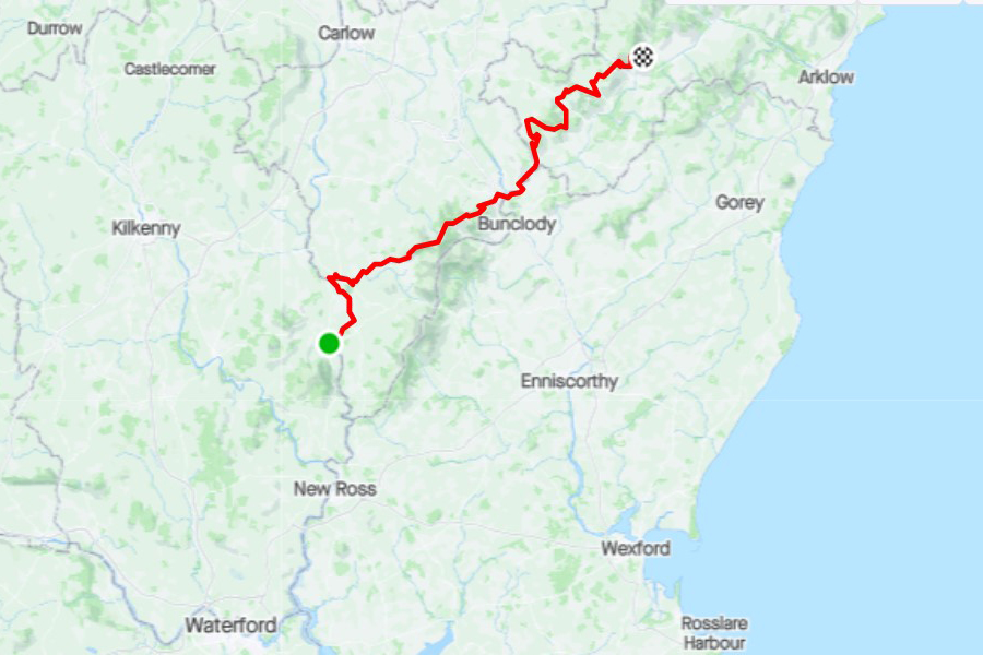
Distance stage       77,5 km
Distance acum. 3.421,0 km
Quality of signs good
Quality of the hike B (very interesting): lots of variety in scanery, great views

https://www.strava.com/activities/7917205014

Link to Strava

During my day off, yesterday, I got frustrated that I have to spend one of the very few days that I have available in my calendar to spend in Ireland by taking rest and shuffling around my room without shoes. I want to try to compensate for this loss of time in the days to come.

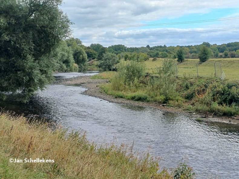
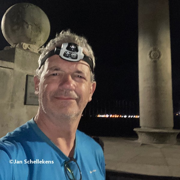
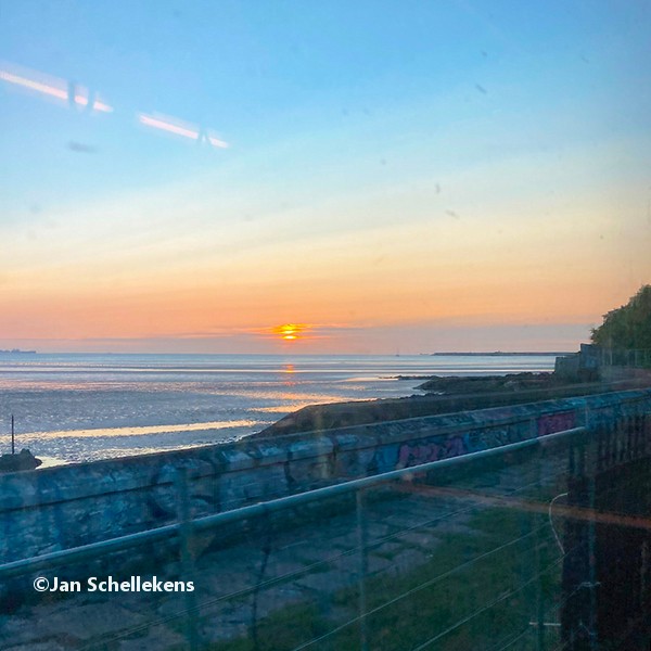
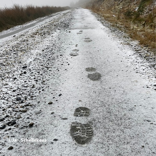
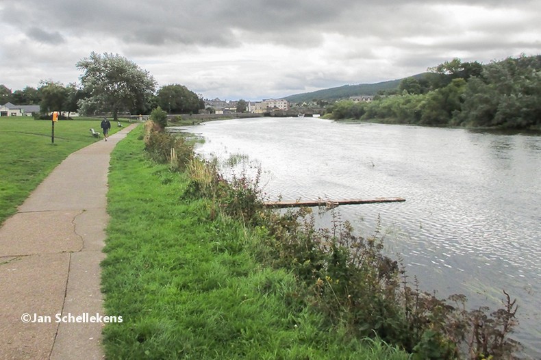
The owner of the B&B apologized yesterday evening for not having any breakfast available before 8.00 (“that’s the pace of rural Ireland”). If I have to leave without breakfast anyway I will use the nightly hours to make it a really great day. I leave the B&B at 00.59 and cross the bridge to the other side of the river.

91 - IMG_2400-DeNoiseAI-low-light

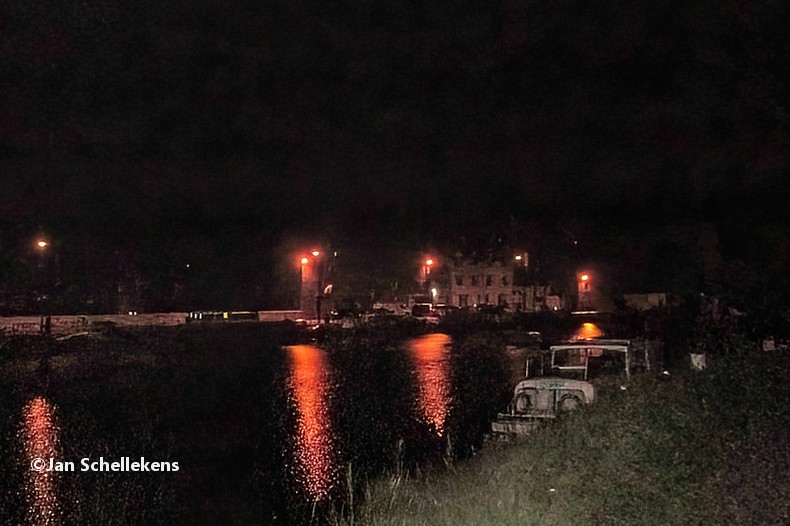
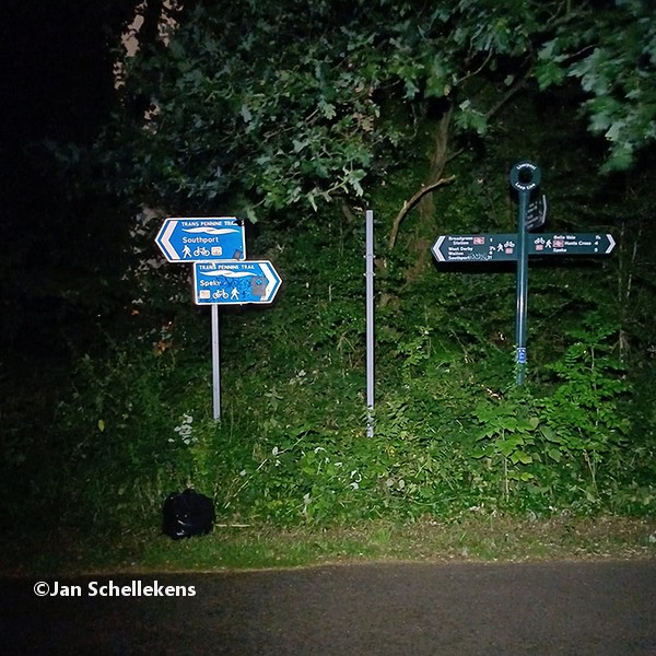
leaving Craiguenamanagh in the middle of the night

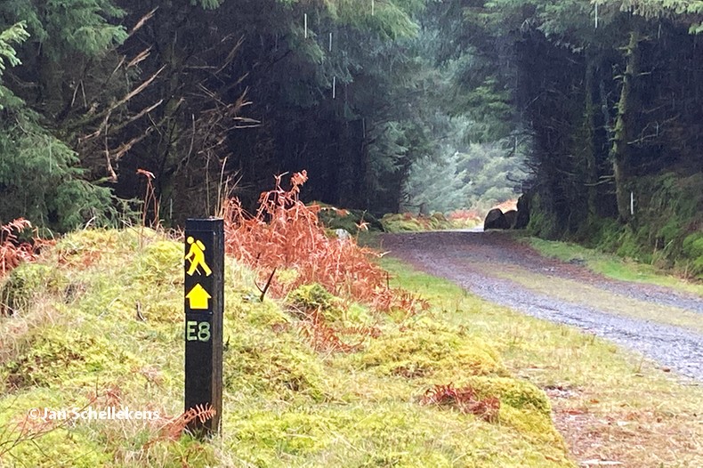
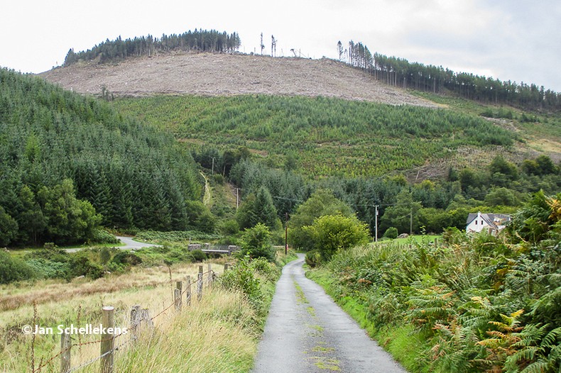
It is as dark as it can get, but after I have left the village and its lights behind me, my eyes start feeling comfortable in the dark. I have my headlight on but I use it only once every two minutes or so for a short flash. The Trail follows the bank of the river, in a narrow trail between the high grass. It is very straightforward; if you fall in the water you have gone too much to the left! After two hours I arrive at the first bridge that crosses the river. I follow the road to the northeast to the village of Borris. The street is empty, but well lit. In Borris I go left / northeast again following the road to Mount Leinster. This countryside road is dark and narrow, but at this hour of the night, at 3.20. it is quiet. The road goes up the hill, with some steep sections. I keep an easy pace, most important is to keep moving as I have a long day ahead of me.

91 - IMG_2404

on the way to Mount Leinster

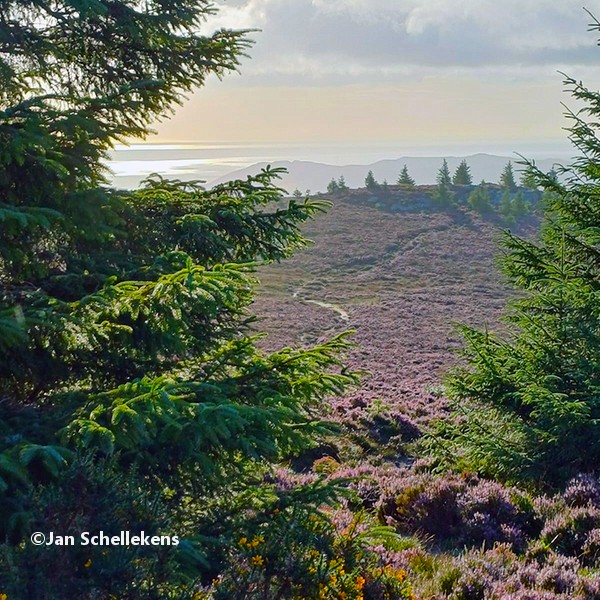
In the early morning light Just after the dawn has started I reach the shoulder of Mount Leinster, 24 kilometers after my start of this morning. The view is spectacular here at 440 meters altitude. It is cold, the sky is clear and there are some low hanging clouds between the hills in the north.

91 - IMG_2439

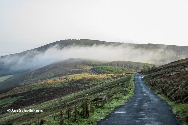
view from (the shoulder of) Mount Leinster

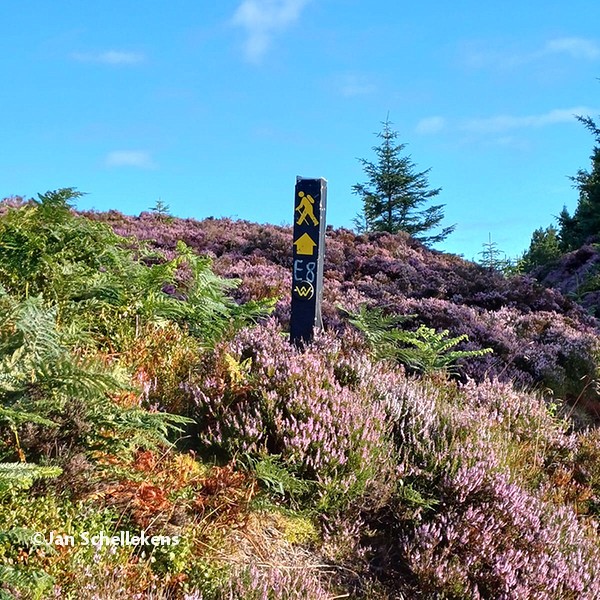
I sit down on a bench to have a break and enjoy the scenery. After 10 minutes or so I have to continue, gently downhill still using the paved road. The signs of The South Leinster Way continue to be very good and lead me to the village of Kildavin, the finish of the South Leinster Way.
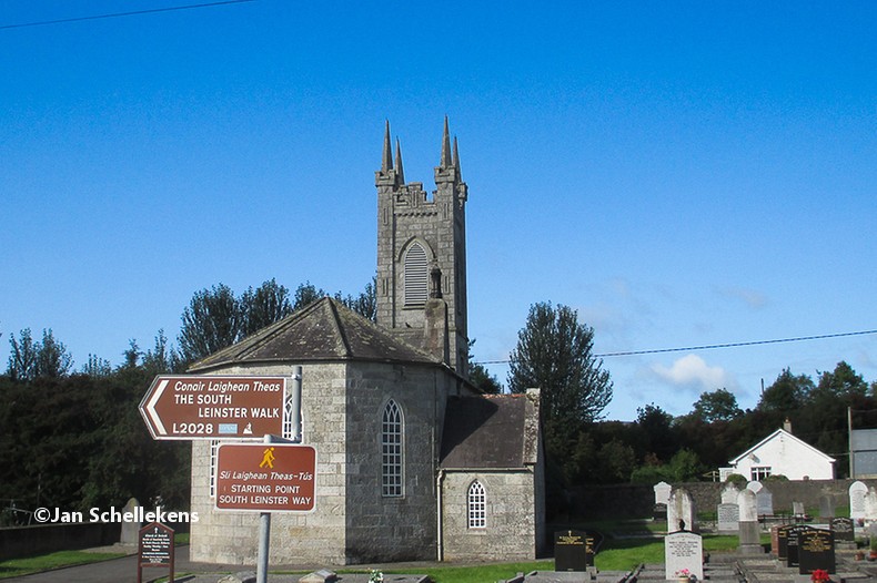
91 - IMG_2460

Kildavin

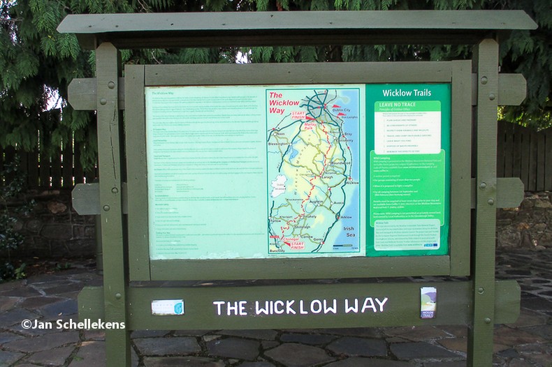
From there it takes some 40 mintes to hike to the village of Clonegal, which is the southern starting point of the Wicklow Way, the final host of the E8 in Ireland. The sky is clear blue, the temperature is bit more than what I would have wished for but it is great to be outdoors. The Trail continues to use the regular paved road, which is boring but easy and welcome to my feet. I leave Clonegal, at the starting sign of the Wicklow Way at 10.00.

91 - IMG_2463

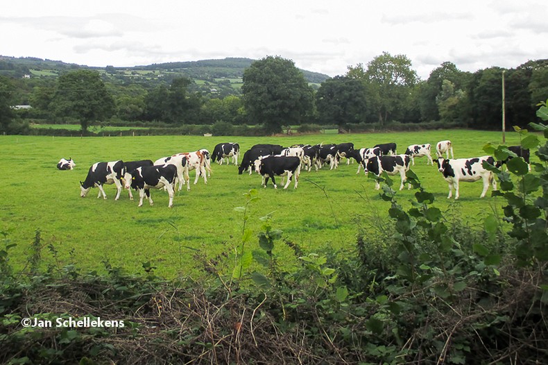
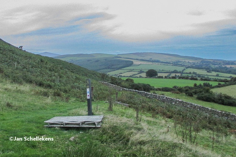
I feel very good, although tired, but it is exciting to realize that I have a big part of the day still ahead of me and that I have already covered 40 kilometers. Further down the road, after some kilometers, the Trail uses here and there forest roads for a while but always comes back to regular roads. The slopes in this southern part of the Wicklow Way are gentle, and although sometimes steep they are never very high. In the afternoon I maintain a reasonable pace, the landscape and the weather are great and I love to be on my way to the horizon. I have a few short breaks every now and then, long enough to recover my breath but short enough to keep the pressure on my feet to keep going. Ona forrest road I meet a hiker who is coming towards me. She is from Belgium, and started last year in Dublin with the Wicklow Way and she is finishing it this year. Although the Wicklow Montains, and the Wicklow Way, are well known for hiking, and August is an ideal month for hiking in Ireland I barely meet others hikers.  At the end of the afternoon I feel that my steps are not as well coordinated as earlier in the day. The Trail is crossing forest roads now, with stones here and there. Although I would have loved to have an 80+ kilometer stage I don’t want to risk of stumbeling and falling. I have been  checking for a place to have a dinner or to sleep but I am crossing the middle of nowhere.

91 - IMG_2489

I feel very well, although very tired, and I don’t want to leave the Trail for luxury such as a hot meal or a bed. From 18.30 on I am looking for a good bivouac location and finally, at 19.15, I find one; I call it a day high on a hill southwest of Tinahely, from where I have fantastic views to the southwest where I can see all the way to the Irish Sea. Below me is a meadow and in the valley there are some farm houses. It is quiet, the sunlight is fading away and I am glad not having to walk anymore.

Geplaatst in 1 - Ireland | Tags: | Plaats een reactie

Mullinavat – Craiguenamanagh

90 Mullinavat - Graiguenamanagh

 Stage no. 90
Date Monday 27 August 2018
Distance stage       48,5 km
Distance acum. 3.343,5 km
Quality of signs good
Quality of the hike C (interesting): paved roads and some nice scenery

https://www.strava.com/activities/7917194887

Link to Strava

Again a hiking day without a proper breakfast. I leave the B&B at 4.55 and I start the E8, where I left it yesterday, at 4.59. My feet are really hurting and I get back in a, somehow, modest pace only after a while. The direction of the Trail is more or less straightforward northeast bound. I prevent standing still as it causes much pain to get moving again. Around lunchtime I arrive in the village of Inistoge, after passing the “wall of shoes”.

90 - IMG_2384

The village has a lovely square, with a small grocery shop (lunch!) and  some benches that provide a great place for a little rest. The weather is delightful, and after lunch I have huge difficulty in getting to move again. Leaving Inistoge the Trail leads up the hill in wide curves. There are very few people out in the hills and in the forest. The final kilometers of today are getting more and more of an ordeal due to the pain in my feet. During the day I have tried to find a B&B in the village of Graiguenamanagh but I was not successful. After a long downhill section I arrive in the tiny village along the river Barrow and I ask here and there for a B&B. I find one on the side of the river, close to the city center.

I have dinner in the local snackbar (pizza with dipsauce) and I decide to take a day off tomorrow to give my feet a break.

90 - IMG-20180827-WA0003

Geplaatst in 1 - Ireland | Tags: | Plaats een reactie

Clonmel – Mullinavat

89 Clonmel - Mullinavat

 Stage no. 89
Date Sunday 26 August 2018
Distance stage        50,0 km
Distance acum. 3.295,0 km
Quality of signs good
Quality of the hike D (boring): many paved roads in a not so great scenery

https://www.strava.com/activities/7917189705

Link to Strava

After again one year since my last stage I am back in Ireland with the usual itinerary: home -> Amsterdam -> Cork -> starting point. On this arrival day I take it easy and do some sightseeing in downtown Clonmel. I also check the shortest way from my B&B (same as the last two nights of my previous trip) to the bridge that is situated south of the city center.

After I have enjoyed a good breakfast in the B&B I start my hike at 07.00 at the bridge. I have new hiking boots which should reduce, or eliminate, the many problems that I have with my feet during hiking. I have not been able to train on these and to compensate for that I have also taken my outdoor Crogs with me. During the first kilometers it rains and my Crogs cause me some scarcial blisters, already within one hour! After the weather has cleared I put on my boots, which I should have done from the start. The Trail is heading for Carrick-on-Suir, which is some 20 kilometers down the river, but it would be too easy (and boring!) to follow the cycling path downstream. Consequently the Trail leads up a hill for some useless kilometers on a (dangerous!) road with high hedges on the sides. Fortunately halfway up the hill there are new signs that indicate that the Trail goes east, back down to the river instead of having to go all the way up. Back in the valley, near the village of Kilsheelan, the Trail follows the cycling path along the Blackwater river; it is made of spotless concrete and every 300 meters there is a bench that provides a seat for the many fishermen that try their luck in the river.

on the way to Carrick-on-Suir

At 11.40 I arrive in Carrick-on-Suir (halfway the Irish section of the E8!) and I get myself lunch in the local supermarket. Thanks to the comfortable and flat kilometers until here my pace is very good, and I have lunch while moving onwards. During the afternoon many kilometers are crossed on paved roads, which makes it easy to maintain a high pace, but it is boring.

After almost 50 kilometers I decide to call it a day in the village of Mullinavat: “there is a house (B&B) in Mullinavat, they call The Rising Sun”. It is situated on the Trail, on the main road in the village, and it has a spare room (not a cheap one). After I have checked in, I notice that my activity app shows that I have covered 49,8 kilometers today. I leave the B&B and follow the E8 for another 200 meters until the app indicates the 50,0km. It is just within ten hours after I have left Clonmel, this morning. It was a great day, hopefully the blisters on my feet will be easy on me in the next days.

Geplaatst in 1 - Ireland | Tags: | Plaats een reactie