
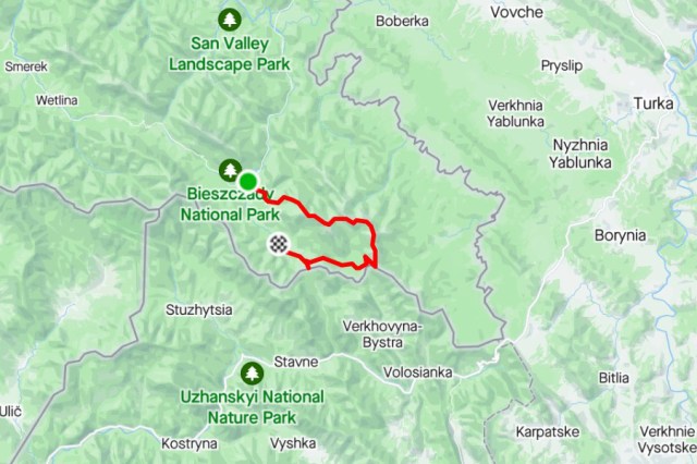
| Stage no. | 80 |
| Date | Sunday 27 April 2014 |
| Distance stage | 26,5 km |
| Distance acum. | 2929,5 km |
| Quality of signs | very good |
| Quality of the hike | A (excellent): hills and great views |
| Link to Strava |
At 05.00 I am back on the Trail again, for my final day to the Ukrainian border.
I pass the bus stop and go right to the big parking lot. There the path goes up the hill through the forrest, again very well prepared: boards are covering muddy sections, steep parts are supported with railings and stayed steps, it is all very impressively taken care of. Some will say that this makes it very artificial to walk here, but I am happy that I am able to look around me and enjoy the scenery while walking in stead of looking at my feet only to make sure I put them down safely. Again at approximately 1000 meters altitude I leave the tree line and it gets very cold due to the fierce wind. The sky is blue, the views from the ridge are great and Wolosate is far in the deep on the right hand side. On the pass Tarnicka I decide not to climb the Tarnica hill, which is a supplement just off the E8-Trail and it must provide a fantastic view on the valley. I continue my way down to the bivouac shelter, where I have a break. In the valley that is crossed consequently to the east the temperate gets comfortable again.
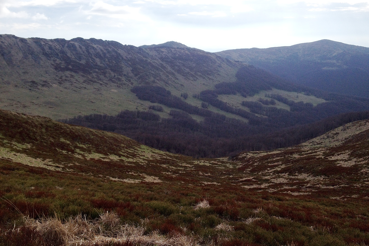
View from the shelter to the Halicz hill
After reaching the ridge again the Halicz hill needs to be climbed. From a distance this looked very tough but it is well to do. Also here there are many supports on the path for those who could need it. The views from the top are superb, also to the lower hills in the east. After a steep descent and a short ascent I start the final descent to the Ukrainian border. At the end of the descent there is again a bivouac shelter. Just 50 meters from here is the Ukrainian border, clearly marked by a Polish and a Ukrainian landmark. I take the inevitable pictures, also when some Polish hikers join me on this location. After picking up some souvenirs (little rocks with paint from the landmarks) I go back to the bivouac shelter and continue my way down. Close to the bivouac shelter there is a huge lavatory building, which indicates that it can be pretty busy around here. I follow the road down the hill and every few minutes there are hikers coming up the hill to enjoy a great day up in the hills. After reaching the valley the road continues towards the village of Wolosate. Just before the end there is a road to the left/south that crosses the creek and leads to the Beskiden Pass. The signs say that that the road is closed and not to be used, and that is also what the officer of the borderpolice tells me after I did cross the bridge. I manage to visit the Beskidenpass, together with him, and he takes a picture of me and we walk back to the bridge again.
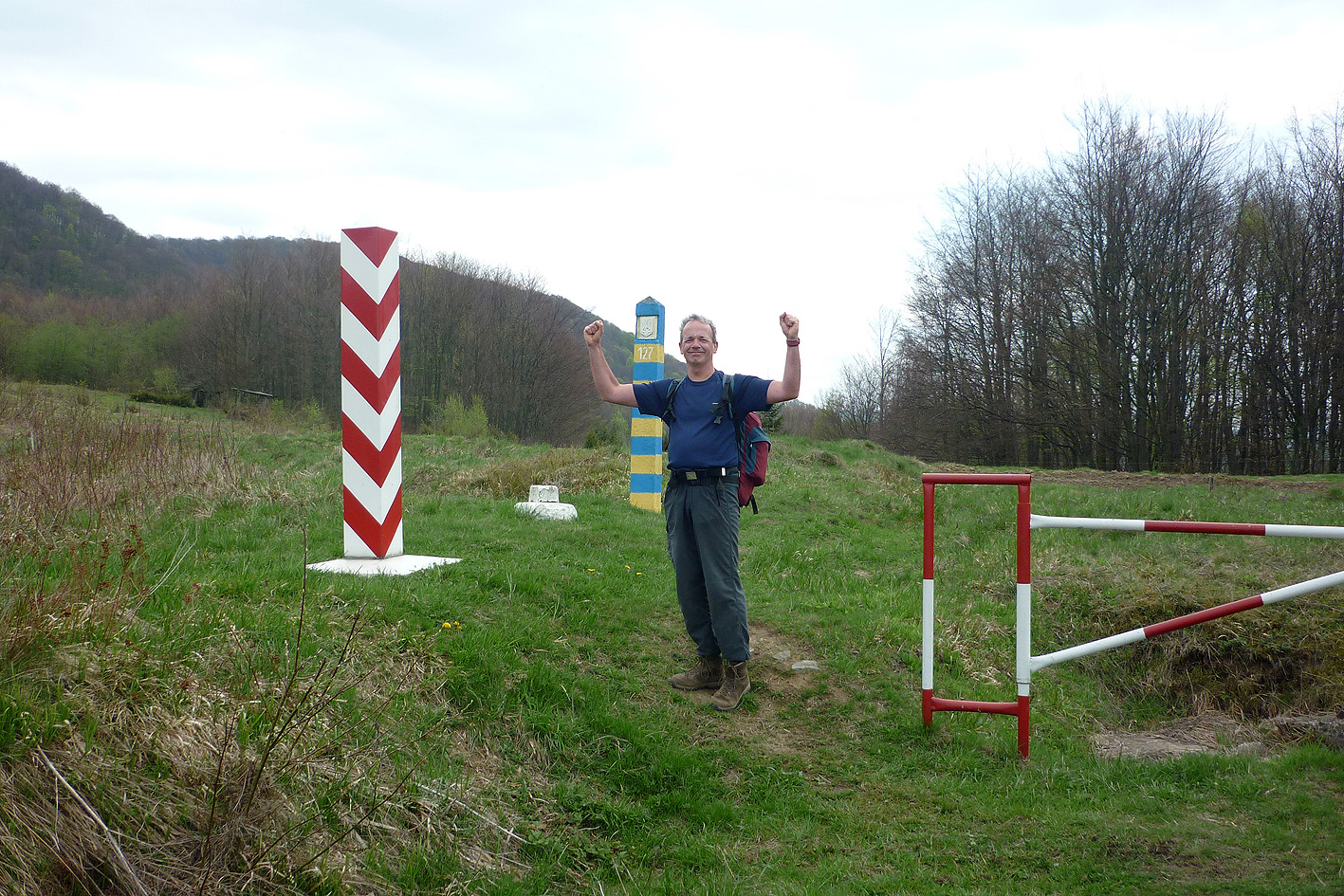
Ukrainian border at the Beskiden Pass
The rest of the road to Wolosate is easy; many tourists are by now swarming around the tiny village, enjoying the scenery. In Wolosate, oposite the parking lot there is the last E8-sign. It is for the first time in 21 years that I finish my trip without seeing the sign that indicates where I should be going the next time.
